They say timing is everything and ours was about spot on.
Did you know that Denali (formerly Mt. McKinley), all or part of it, is obscured by clouds or fog 80% of the time? Denali is so tall it makes its own weather. We were very lucky to have been able to see what we did.
After glimpsing the mountain at various spots before reaching Trapper Creek the previous day, our good fortune continued as we drove north to Denali Park.
 |
| Denali View Along the Parks Highway |
 |
| View from Veterans Memorial @ Byers Lake |
 |
| See-More @ Byers Lake with Denali in the Background |
 |
| Another View Along the Highway |
 |
| Panorama from Denali View North State Park (Click to enlarge) |
It would be a short travel day - only about 130 miles to cover. We stayed about eight miles north of the Denali Park entrance road. Not only were we looking forward to visiting Denali, my sister and brother-in-law were due to arrive in Healy via private plane in the afternoon. Yep, Jim piloted his Cessna plane up from the Seattle area so they could spend time with us at Denali.
 |
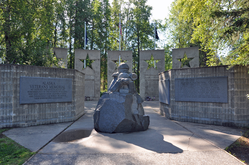
| Veteran's Memorial @ Byers Lake |
 |
| Inside the Memorial |
 |
| Unfinished Igloo City Hotel on the Parks Highway |
During check-in at the RV park, we overheard one of the employees tell a caller that tents were not allowed in their park. Uh oh. Jim was planning on sleeping in a small tent with their dog, Daisy, in our campsite. Hmmm...what to do, what to do? See-More has a set of large bunk beds in the back but we removed the lower bunk before leaving home, and the mattress from the upper bunk was pulled, too. The space was being utilized for storage purposes. Out came the bins from the top bunk area and in went Mom's 2" foam mattress topper. This would be Karen's sleeping area. Luckily they had a sleeping bag with them. Mom moved from the convertible dinette bed to the sofa so that Jim would have a place to sleep. Okay, humans are taken care of. Now to deal with the dog situation. Daisy, the golden retriever, and Trip, the German Shepherd, are not the best of buds. Daisy is also known to chase cats on occasion. This could be a problem. Guess what? It wasn't too much of an issue after all. We were able to use Trip's crate for Daisy to sleep in at night. That kept the cats safe. After day one, we didn't bother securing the cats when Daisy was in the trailer. She didn't chase the cats and at least Baby Girl gave her the cold shoulder. However, CK kept his distance and a watchful eye on Miss Daisy. When the dogs were outside, both were on leads at opposite ends of the trailer. No dog fights. We did not let them hang out in the trailer though. Why chance it? We ended up with five adults, two large dogs and two cats in See-More. It all worked out and we had a great time together.
 |
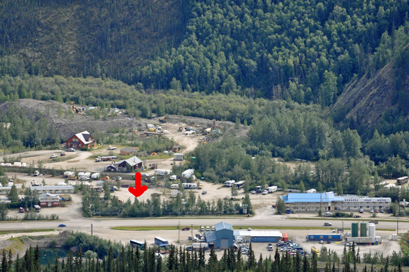
| See-More @ Denali Park RV |
Denali National Park contains over 6,000,000 acres with a single 92-mile-long access road into the park. Private vehicles are not allowed in Denali National Park past milepost 13. Buses are the primary mode of transportation beyond that point. Our first day in the park, we visited the Wilderness Access Center where shuttle bus tickets were purchased for four of us for the trip the next day out to Eielson Visitor Center at milepost 66 that would take approximately eight hours for the round trip. George would not be going since he has made that trip two times before. He offered to dog sit so the rest of us could ride the bus. Then we went to the Visitor Center and also checked out the Train Depot where the Alaska Railroad trains come in. Outside of the park entrance, Princess of cruising fame, has a huge lodge facility. They also have their own train and cars, as does Holland America and who knows what other cruise line, bringing passengers to Denali. We scoped out the Riley Creek campground before returning to our own campsite. (Next time I want to stay in the park, maybe even out at Teklanika.)
 |
| Almost like a mushroom cloud (of the bad kind) |
 |
| Princess Cruises Train @ Denali NP |
 |
| Holland America Train |
Our shuttle bus reservation was for the 8:30 a.m. trip. We wanted to be there early so we could be first in line. One of the campground hosts told us to sit on the driver's side of the bus and we wanted to make sure we had that option. You have to take your own food and water on the trip out since there are no concessions available out in the wilderness. Bathrooms, yes. Food, no. And you can refill your water bottle at the visitor center. We were prepared for the day including our raincoats since liquid sunshine was in the forecast. We boarded the bus and off we went on our big adventure into the Denali wilderness. A ranger briefly got on our bus at mile 13 and we learned the American Sign Language signs for the five big animals found in the park - the grizzly or brown bear, moose, caribou, Dall sheep and wolf.
Moving on, it wasn't long before we spotted our first wild animal - a caribou, standing in the road. A few miles later we saw our first brown bear. Whoa! This is a cool trip already and we still have many miles to go! What is nice is that the buses stop for wildlife sightings for us silly tourists to take photos. Rules are...be quiet and no hanging out the windows. The animals are acclimated to sound of the vehicles and the park rangers want to keep it that way. If the animals get used to human voices, then it puts both animal and man in danger. So silence!
 |
| Caribou in the Road |
 |
| Our First Grizzly Bear Sighting |
We saw several more caribou. Poor things. It was hot (probably around 80 degrees) that day and the 'bou don't care for the heat nor for the mosquitos and flies that are extremely attracted to them. A caribou will seek out the gravel bars in the rivers away from the bushes and bugs, hoping for a breeze and some relief. A caribou can lose up to a half-pint of blood per day to those pesky mosquitos. Note: if someone offers you a new perfume or cologne called Me and My 'Bou, do not, I repeat, DO NOT accept it. Unless you wish to be a daily blood donor yourself. Surprisingly, the moose are not bothered by the mosquitos and flies to the extent the caribou are.
 |
| Another Caribou Escaping the Skeeters & Flies |
Driving along, a mama bear with two cubs were spotted just off of the road in a drainage area. Not only did the bus driver stop, she shut off the engine, too. We could listen to the sow and her cubs interacting. At one point, the mama bear moved out of sight of her cubs. One cub quickly followed mom while the other was off in la-la land doing something else. Then he (or she) realized the other two bears were gone and he stood up on his hind legs and called for mom. After hearing Mom respond, he scampered off towards her. Oh, so cute to watch and listen!
 |
| Grizzly Sow & Her Two Cubs |
 |
| One of the Bear Cubs |
 |
| Another view of Mama Bear |
The buses do stop for a couple of potty breaks and photo ops before reaching the Eielson Visitor Center. These are shuttle buses and are on a schedule, somewhat. If the driver tells you it is a planned ten-minute stop, then you had better be back on the bus by then if you want to continue riding it. Otherwise, you will be left standing in the dust as it pulls away as a couple of the passengers found out the hard way. We stopped at the Polychrome Overlook for the aforementioned ten-minute stop. The two seats directly across the aisle from us remained empty except for a backpack when the doors closed and the bus departed. Next stop - Toklat. The driver said the missing riders would eventually catch up with us and their stuff. Buses run frequently along the park road. Sure enough, at our next stop eight miles away, the couple re-boarded after catching another bus. Lesson learned. Do not be late unless you do plan on riding another bus. It is a shuttle bus system and you can easily change buses if you want, space permitting.
 |
| Teklanika River |
 |
| Panorama from Polychrome (click to enlarge) |
Earlier on our ride out to Eielson, we were able to see the two peaks, the taller South one and the North one, plus the base of the mountain. The middle of the mountain was hidden behind clouds. By the time we reached the visitor center about three hours later, the mountain was completely obscured. Good thing we saw it on previous days.
 |
| South & North Peaks of Denali Above the Clouds |
 |
| Another Peek of the Peaks |
The bus had a planned 30-minute stop before returning back to our starting point. We ate lunch on the bus at the request of the driver. It is preferred that you eat on the bus so food is not inadvertently left for bears and other critters to find. You are also asked to pack your own trash out, although there was a large trash bag on the bus available for use. We wanted to be on the same bus in the same seats on the return trip so you can bet your sweet bippee we were on board at the designated departure time.
 |
| Panorama from Eielson Visitor Center (click to enlarge) |
 |
| "Seasons of Denali" - Quilt @ Eielson Visitor Center |
We saw Mama Bear and her cubs again quite a distance from the earlier sighting. We were amazed how far they had traveled in a short period of time. Once again the engine was turned off so we could watch and listen. We spotted another caribou running down a gravel bar towards our bus, trying to escape the bugs, no doubt.
 |
| Running from the Devil(s) |
The rains finally came as we approached Polychrome but did not last long. They did get things wet and muddy enough to mucker up the windows of the bus and reduce our visibility and wildlife spotting abilities. I must say the road near Polychrome is not for the faint hearted. Don't look down if you are afraid of a narrow road along a ledge way up high. For those who are familiar with Dead Horse Point on the road to Hart's Pass near Mazama, Washington, it is very similar, only a longer stretch of road.
 |
| Road Near Polychrome Overlook |
 |
| Do. Not. Look. Down! |
We picked up a few hikers along the road on our way back to the Wilderness Access Center where our journey began. We were tired after a long but very rewarding day. Not only did we spot bear and caribou, we also saw Arctic ground squirrels, ptarmigans, and some kind of grouse that I forgot the name. The shuttle buses are a great way to see Denali National Park and I think taking the 13-hour round trip out to Wonder Lake and Kantishna would be a blast. Next time, perhaps.
I have yet to see a male moose or Dall sheep though. I must keep looking and hope the opportunities present themselves in the coming days.
On Saturday after laundry and other minor chores were completed, the ladies went of search of trinkets at the many gift shops outside of Denali National Park. We needed cough syrup, too. George had been battling a cold and now Mom and I were starting to develop symptoms. Mission accomplished with a bottle each of NyQuil and DayQuil in the shopping bag.
Sunday was departure day for all of us. Jim and Karen would be flying to Anchorage for a few additional days of exploring, and we would be heading north to Fairbanks. We said our goodbyes in the morning with thoughts of doing a similar get-together in the future. It was a fun few days. Visiting Denali was a great experience.